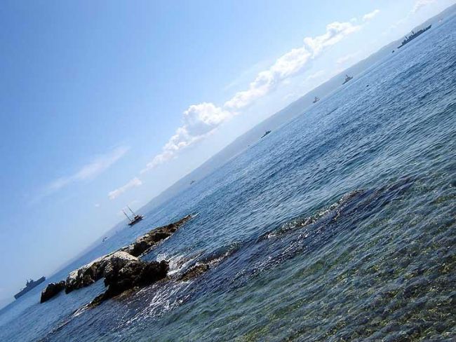
Adriatic sea
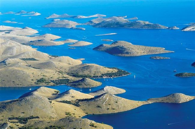
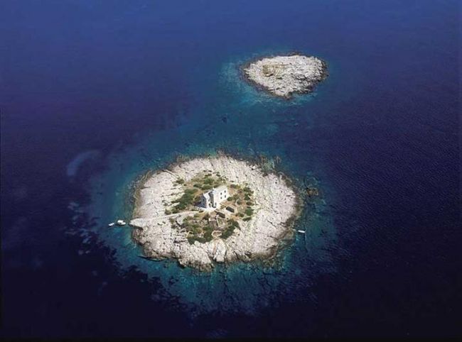
The part belonging to the Republic of Croatia is the east coast which extends all the way from Prevlaka in the south to cape Savudrija in the west, including all islands, islets and cliffs along the coast, and the archipelago of Palagruza (the number of islands, islets and cliffs is more than 1700). This is a unique area in Europe for cruising with motor boats, speedboats, or sailboats, but also for enjoying the underwater world.
Depths: The shallowest part of our sea is in Istria, where the depth does not exceed 50 metres. From Pula, the seabed mildly drops, making a long, narrow valley which extends from Zirje towards Italy which is called Jabucka kotlina. The biggest depth there is about 240 metres. From Jabucka kotlina, the bottom rises to Palagruza reef where the biggest depth is 130 metres. Towards the south, the bottom drops steeply towards the Juznojadranska dolina, where the biggest measured depth is about 1,300 metres.
Seabed: The appearance of the underwater relief is the consequence of tectonic movements, abrasion or erosion which were active several million years ago, in times when certain parts of the seabed were land or the coastal area. Uneven areas on the bottom are constantly reduced by sedimentation of detritus from the land. That process is slow, but constant.
Tides: In the Adriatic, the high and low tides have relatively small amplitudes. In the southern part, the difference is rarely above some forty centimetres, while in the northern part it is somewhat bigger, so that it comes to 1 metre in Istria and the Gulf of Trieste. In some narrow channels and bays, the high tide can grow considerably during a strong sirocco. That phenomenon is characteristic for big and deep bays of the southern Adriatic. The tides are of a mixed type, which means that their rhythm is semidiurnal during the new and full moon, and of a daily type during the first and the last quarter. Their amplitudes are very irregular.
Sea Currents: Sea currents occur under the influence of winds, the difference in pressure, temperature, and the differences in salinity. With respect to the direction, they can be horizontal or vertical. There are also bottom currents which appear as the consequence of moving of water from warmer areas to colder ones, during which the surface layer gets cold and descends towards the seabed. Currents are weakly observable in the Adriatic.The speed of currents changes in particular areas, but it also depends on time periods. The average speed of currents is about 0.5 knots, but they can also reach the speed of 4 knots.
Salinity of Sea: The total quantity of salt dissolved in one kilogram of sea water is called salinity, which is usually expressed in grams and as the permillage. The salinity of the Adriatic Sea is 38.30 per mill averagely, i.e. there is 38.30 g of salt dissolved in 1 kg of water. In the northern part, the salinity is somewhat lower than in the middle and southern part because of the influence of the Po River.
Sea Temperature: The Adriatic Sea has a very marked annual change of the surface temperature. The average annual temperature is 11°C. During the winter, the sea is the coldest and the surface temperature is about 7°C; very seldom, it can drop below that too. In the spring, the sea becomes warmer, and the surface temperature rises to 18°C. In the summer the surface of the sea reaches a very high temperature, of up to 22 to 25°C, and in the southern Adriatic and Istria up to 27°C. In the Adriatic, thermoclines, i.e. parts of the water column of the same temperature, are very well distinguished. The thermocline is most evident during the summer, and, in the winter, the isothermal process arises, i.e. equaling of the temperature throughout the water column. In the summer, we can notice the first thermocline at the depth of 3 to 5 metres, the next one is at about 12 metres, and yet another one at 18 metres, while below 30 metres the temperature is mostly constant throughout the year.
Waves in the Adriatic: Waves occur primarily as the consequence of the blowing of winds. The bigger the reach, i.e. the surface across which the wind blows, the higher the waves will be. Their strength depends on the configuration and the exposure of the coast. In that way, mixing of the surface layer with water from the deep is enabled, and the interaction between the atmosphere and the sea. We distinguish the crest and the trough of a wave. The length of the wave is the distance between two troughs. Most often, heights of waves in the Adriatic are between 0.5 and 1.5 metres, and they very rarely exceed 5 metres. Climate The climate at the Adriatic is typically a Mediterranean one, with mild rainy winters, and hot and dry summers. The air temperature changes depending on the area. Thus, summer temperatures in July will be about 34°C in the northern part, while in the southern part they will rise even to 38°C. In the winter, the coldest temperatures are noticed in the northern Adriatic (up to -16°C), while they will not have exceeded 6°C in the southern part.
Winds: At the Adriatic Sea, the bora, sirocco and north-western wind blow most often. Data About Weather Weather forecasts are made by the State Hydrometeorological Institute, and they can be heard on VHF frequencies of coastal radio stations and harbor master's offices. They are also broadcast on FM stations or at the end of the news or within broadcasts for seamen. Harbor master's offices constantly send weather reports and warnings on their VHF operating channels, in four languages. It is possible to get forecasts with the presentation of the synoptical situation in all the marinas and harbor offices.
Nautical Radio Service and Communications Service: The whole of the Croatian coast is covered by radio communications rather well. The radio service for protection of human lives and safety of navigation is provided by Plovput from Split, through radio stations Split and Dubrovnik, which cover the southern Adriatic, and Rijeka, which covers the northern part of our sea. According to the standards of the GMDSS system (Global Maritime Distress and Safety System), the channel for automated receipt of digitalized distress calls is the channel 70, after which the communication is transferred to the operating channel of the coastal station, i.e. a harbor master's office (16 or 10). GMDSS system has been in use since 1 st February 1999, and on the present VHF channel for distress calls, the channel 16, constant listening will be possible still for some more time. |